Gulf Coastal Plains
The Texas Coastal Prairies extend westward along the coast from the Sabine River, reaching inland 30 to 60 miles. Between the Sabine and Galveston Bay, the line of demarcation between the prairies and the Pine Belt forests to the north is very distinct. The Coastal Prairies extend along the Gulf of Mexico from the Sabine to the Lower Rio Grande Valley.
The eastern half is covered with a heavy growth of grass; the western half, which is more arid, is covered with short grass and, in some places, with small timber and brush. The soil is heavy clay. Grass supports the densest cattle population in Texas, and cattle ranching is the principal agricultural industry. Rice is a major crop, grown under irrigation from wells and rivers. Cotton, grain sorghum, and truck crops also are grown.
Coastal Prairie areas have seen the greatest industrial development in Texas history since World War II. Chief concentration has been from Orange and Beaumont to Houston, and much of the development has been in petrochemicals and the aerospace industry.
Corpus Christi, in the Coastal Bend, and Brownsville, in the Lower Rio Grande Valley, have seaports and agricultural and industrial sections. Cotton, grain, vegetables, and citrus fruits are the principal crops. Cattle production is significant, with the famed King Ranch and other large ranches located here.


South Texas Plains
This area may be roughly defined as lying south of San Antonio between the Rio Grande and the Gulf Coast. The Plain shows characteristics of both the Gulf Coastal Plains and the North Mexico Plains because there is similarity of topography, climate, and plant life all the way from the Balcones Escarpment in Texas to the Sierra Madre Oriental in Mexico, which runs past Monterrey about 160 miles south of Laredo.
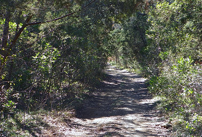
The Plain is partly prairie, but much of it is covered with a dense growth of prickly pear, mesquite, dwarf oak, catclaw, guajillo, huisache, blackbrush, cenizo, and other cactus and wild shrubs. It is devoted primarily to raising cattle, sheep, and goats. The Texas Angora goat and mohair industry centers in this area and on the Edwards Plateau, which borders it on the north. San Antonio and Laredo are its chief commercial centers, with San Antonio dominating trade.
Over a large area in the central and western parts of the Rio Grande Plain, the growth of small oaks, mesquite, prickly pear (Opuntia) cactus, and a variety of wild shrubs is very dense, and it is often called the Brush Country. It is also referred to as the chaparral and the monte. (Monte is a Spanish word, one meaning of which is dense brush.)

Piney Woods
The Pine Belt, called the “Piney Woods,” extends 75 to 125 miles into Texas from the east. From north to south, it extends from the Red River to within about 25 miles of the Gulf Coast. Interspersed among the pines are hardwood timbers, usually in valleys of rivers and creeks. This area is the source of practically all of Texas’ commercial timber production(see Texas Forest Resources, page 107). It was settled early in Texas’ history and is one of the oldest farming areas in the state.
This area’s soils and climate are adaptable to the production of a variety of fruit and vegetable crops. Cattle raising is widespread, along with the development of pastures planted to improved grasses. Lumber production is the principal industry. There is a large iron-and-steel industry near Daingerfield in Morris County based on nearby iron deposits. Iron deposits are also worked in Rusk and one or two other counties.
A great oil field discovered in Gregg, Rusk, and Smith counties in 1931 has done more than anything else to contribute to the economic growth of the area. This area has a variety of clays, lignite, and other minerals as potentials for development.
Regions
Post Oak Belt
The main Post Oak Belt of Texas is wedged between the Pine Belt on the east, Blacklands on the west, and the Coastal Prairies on the south, covering a considerable area in East-Central Texas. The principal industry is diversified farming and livestock raising.
Throughout, it is spotty in character, with some insular areas of blackland soil and some that closely resemble those of the Pine Belt. There is a small, isolated area of loblolly pines in Bastrop, Caldwell, Fayette, and Lee counties known as the “Lost Pines,” the westernmost southern pines in the United States. The Post Oak Belt has lignite, commercial clays, and some other minerals.
Blackland Prairie
The Blackland Belt stretches from the Rio Grande to the Red River, lying just below the line of the Balcones Fault and varying in width from 15 to 70 miles. It is narrowest below the segment of the Balcones Fault from the Rio Grande to Bexar County and gradually widens as it runs northeast to the Red River. Its rolling prairie, easily turned by the plow, developed rapidly as a farming area until the 1930s and was the principal cotton-producing area of Texas. Now, however, other Texas areas that are irrigated and mechanized lead in farming.
Because of the early growth, the Blackland Belt is still the most thickly populated area in the state and contains within it and along its border more of the state’s large and middle-sized cities than any other area. Primarily because of this concentration of population, this belt has the most diversified manufacturing industry of the state.